I don't post about the weather (as opposed to climate) much here because it's both local and transitory. But there are some weather phenomena that are both long-lasting and wide-ranging, and the Polar Vortex is one of them. It's also a term that's often misunderstood and hence misused.
Here's an article that both explains, in great detail, what the Polar Vortex is and provides a forecast of how it will affect the weather during the latter part of January. If you live in Europe or North America, you probably won't like it very much.
Looking 10 days ahead, we can already see a pretty wintery pattern. A strong high-pressure blocking system over Greenland appears around this time. It could be related to the stratospheric events, but further analysis will have to confirm a direct or indirect relation to it.
Such a strong blocking of course means lower pressure in the eastern United States and over the Siberian sector and Europe. We can see a negative anomaly extending towards Europe, imply a likely corridor for colder air transport, in a quasi cross-polar flow.
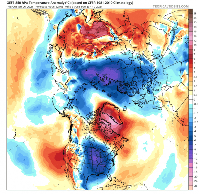
Temperature anomalies also show a quite phenomenal winter pattern. Displaced by the high pressure over the Arctic regions, the cold air sweeps down into the central and eastern United States. We can also see a large area of colder than normal temperatures extending from the Siberian sector all the way into western Europe.
Time to dig out the long underwear, I guess.
No comments:
Post a Comment